
Great Loop Maps and Routes
It can be hard to wrap your head around a six-thousand mile journey! We’re making a series of Great Loop maps highlighting different aspects of the Great Loop, from an in-depth route overview of thirty waterways, to seasons and direction of travel. Check back soon for Great Loop maps of alternate routes and side trips!
Route Overview
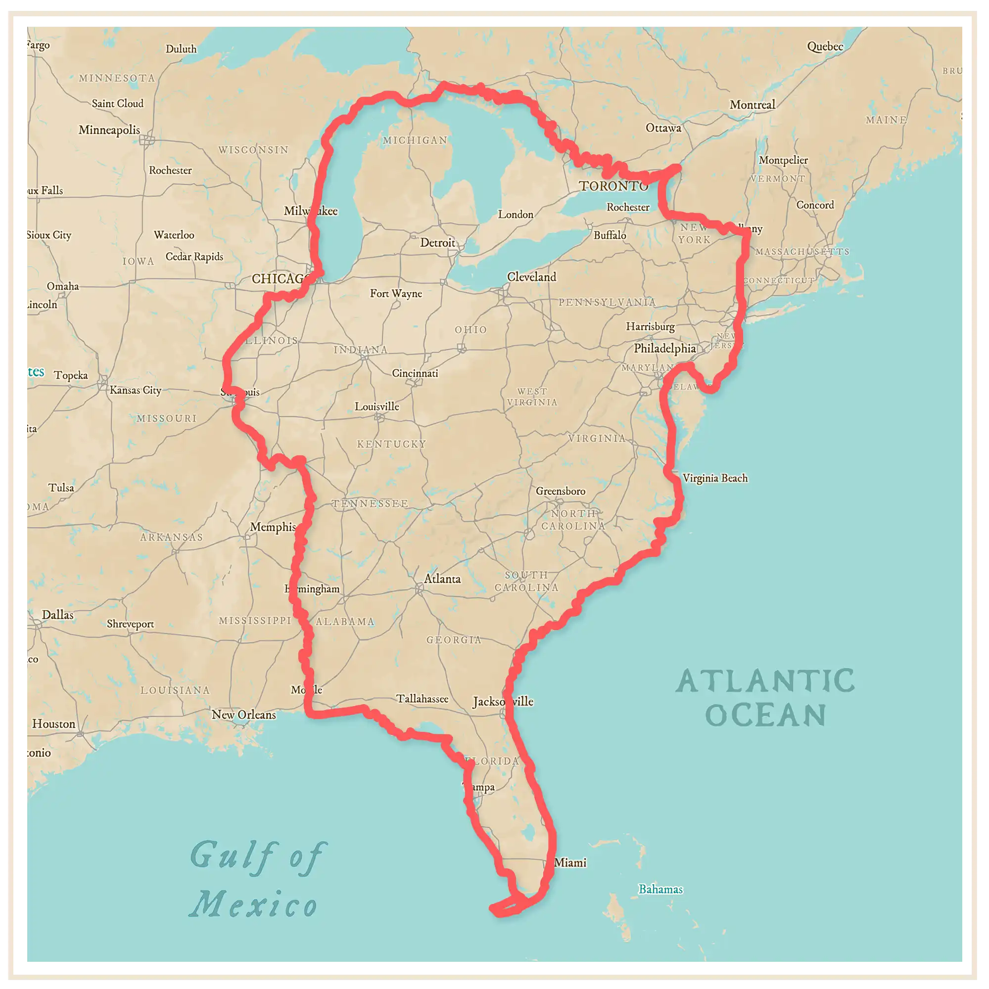
The Great Loop circumnavigates a large portion of North America, traveling through the U.S. and Canada. The route can be divided into six sections:
Seasons of Travel
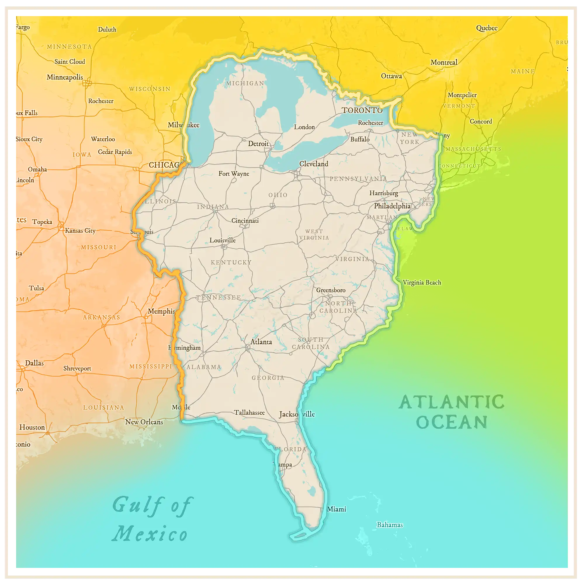
Make the most of the Great Loop by cruising each section during its optimal season!
- WINTER | Florida
- SPRING | Mid-Atlantic Seaboard
- SUMMER | The Great Lakes
- FALL | Inland Waterways
Direction of Travel
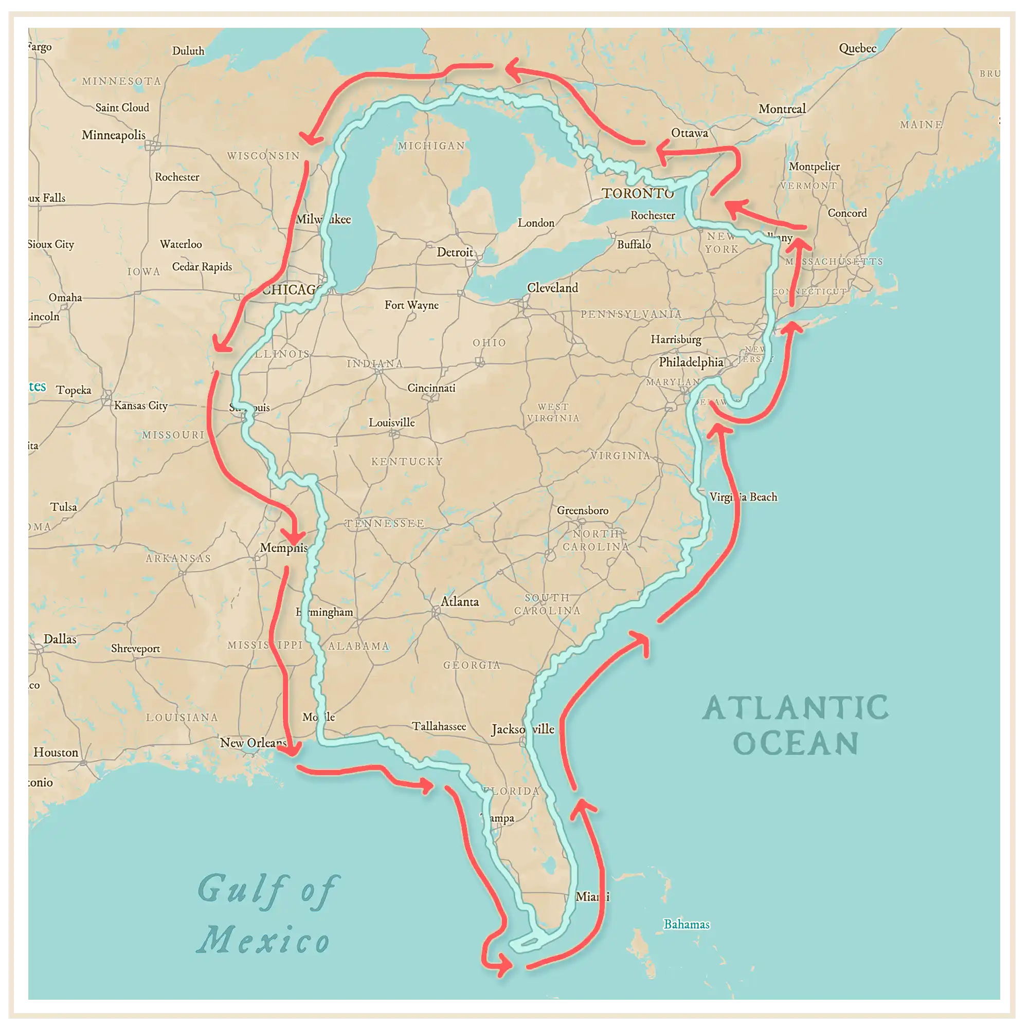
The Great Loop can be cruised in either direction, but the vast majority of Loopers cruise in a counter-clockwise direction, traveling up the east coast and down the inland waterways.
The main reason more Loopers don’t travel clockwise on the Great Loop is the feisty current of the Mighty Mississippi River. If you cruise north on the inland waterways, you’ll be fighting that current the entire way.
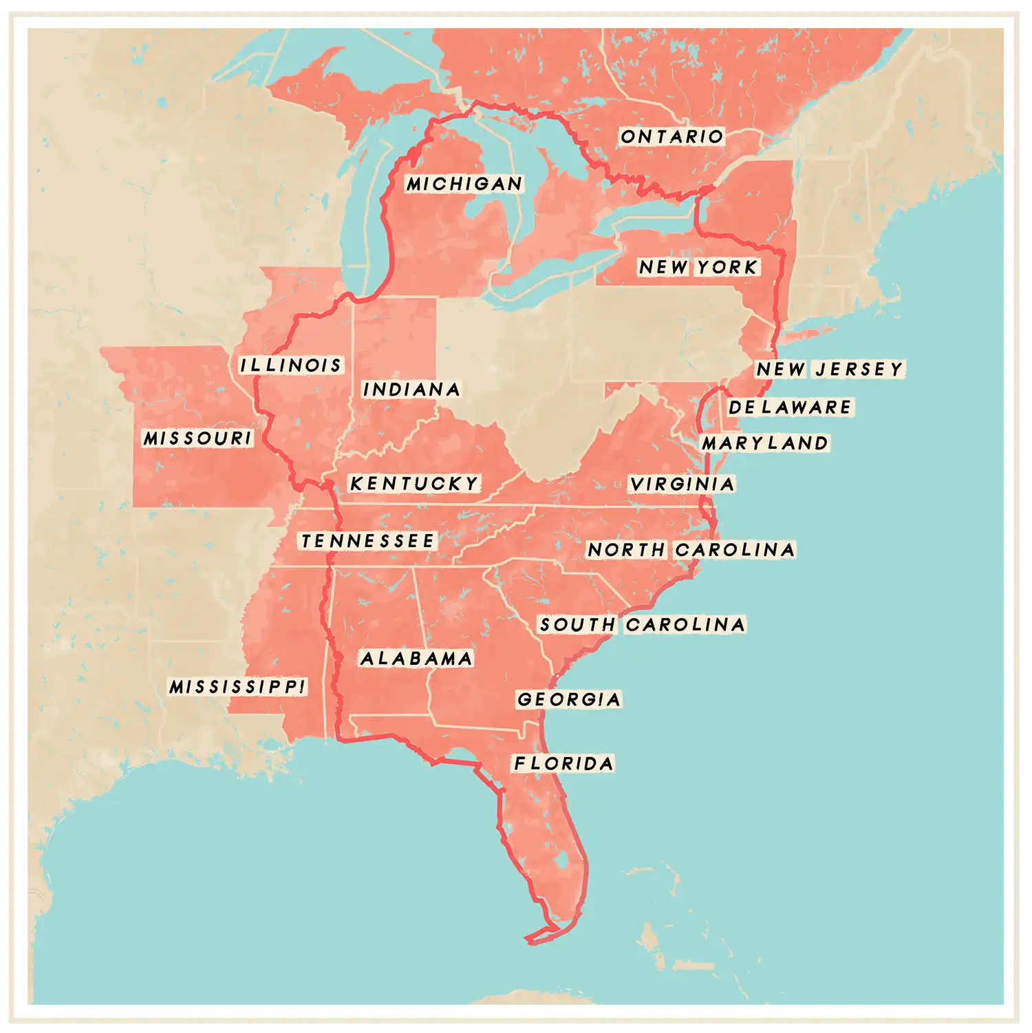
States & Provinces
The main Great Loop route takes you through 17 U.S. states and one Canadian province. Depending on which route you decide to cruise, you could cruise up to 7 additional states and provinces, for a total of 23 U.S. states and 2 Canadian provinces.
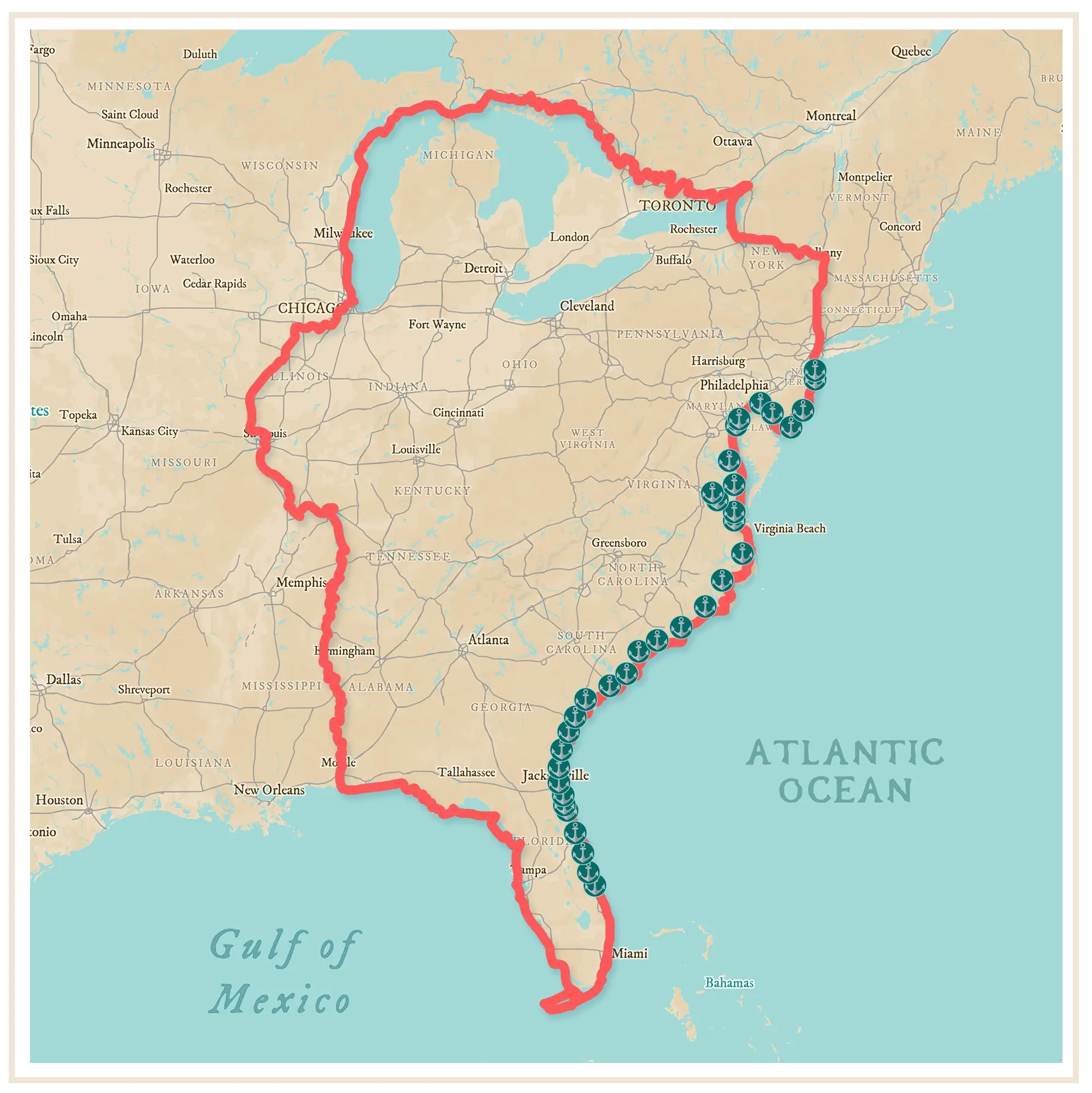
Anchorage Reviews
We’re attempting to cruise all ~6,000 miles of the Great Loop Waterway staying at only free moorings, primarily anchorages. So far we’ve anchored out 89% of the time, and stayed at free docks 11% of our nights!
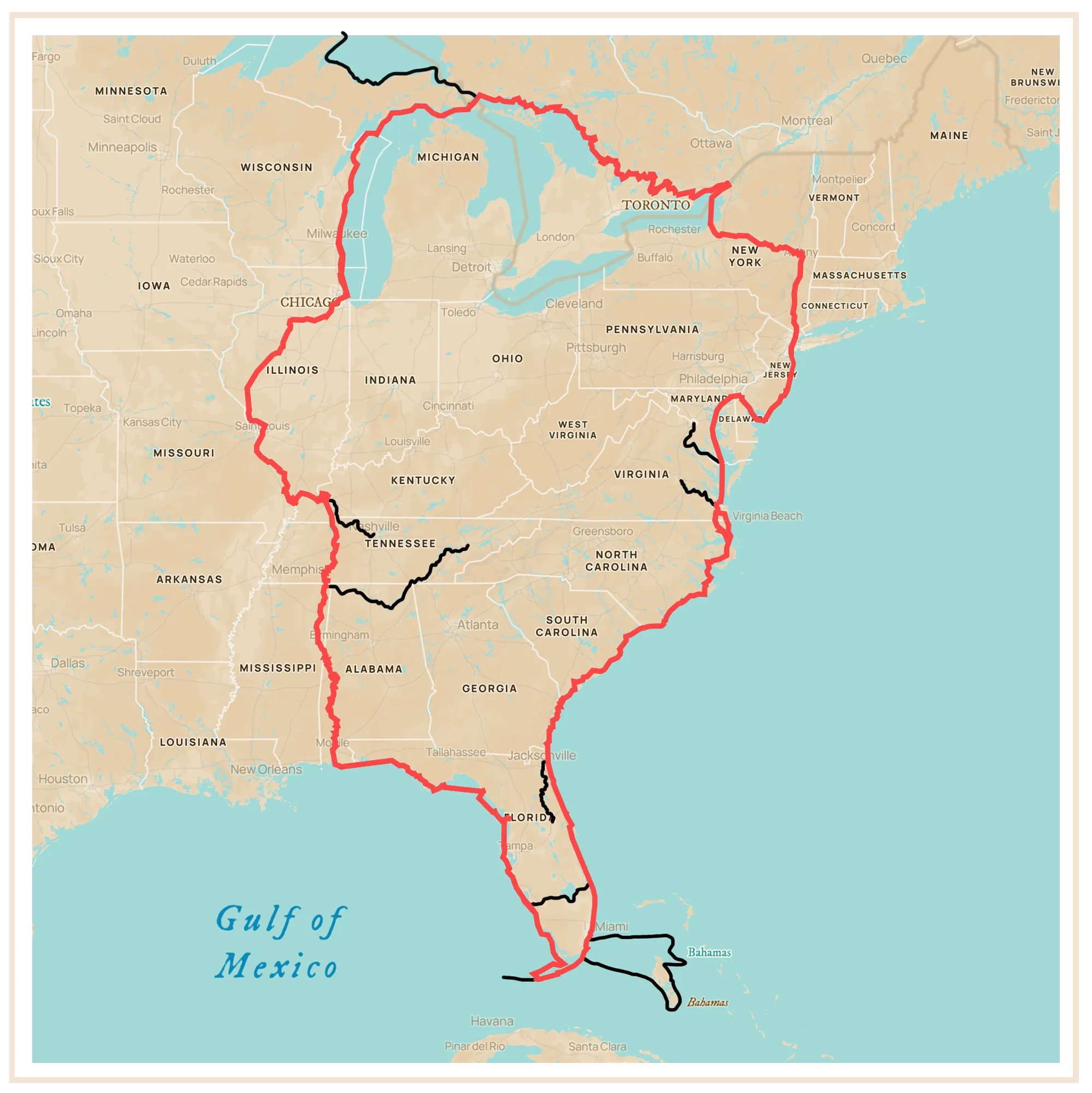
Side Trips
Make the Great Loop your own by veering off the main route and taking one or more of these side trips – or find your own side trip! Some of the most popular side trips are:
- Bahamas
- St. Johns River
- Dry Tortugas
- Richmond, Virginia
- Washington, D.C.
- Lake Superior
- Nashville, Tennessee
- Chattanooga, Tennessee
- Knoxville, Tennessee