
Great Loop Route Overview →
Inland Waterways
The inland waterways stretch from Chicago, Illinois to Mobile, Alabama. The mostly southern-flowing rivers are controlled by series of locks and dams. Watch the beauty of the Fall colors, and travel the incredible vein that moves a nation by water.
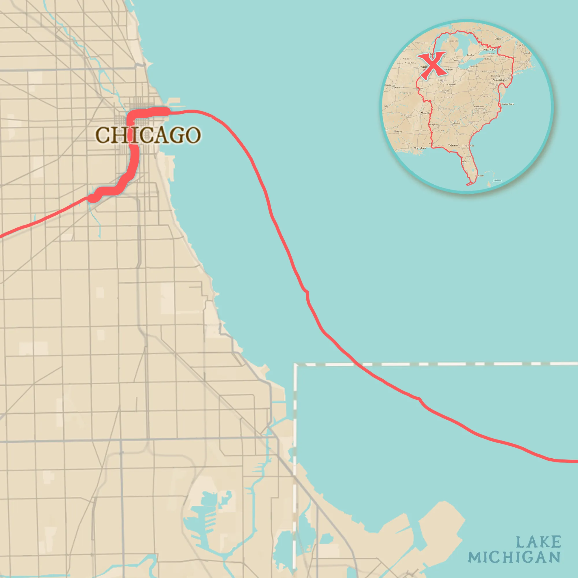
Chicago River
— 5 miles
Leaving Lake Michigan on the Chicago River, Loopers pass through Chicago, Illinois.
Alternate Route
Bypass Chicago by exiting Lake Michigan further south on the Calument River, and navigate the Cal-Sag Channel until it joins the Chicago Sanitary and Ship Canal.
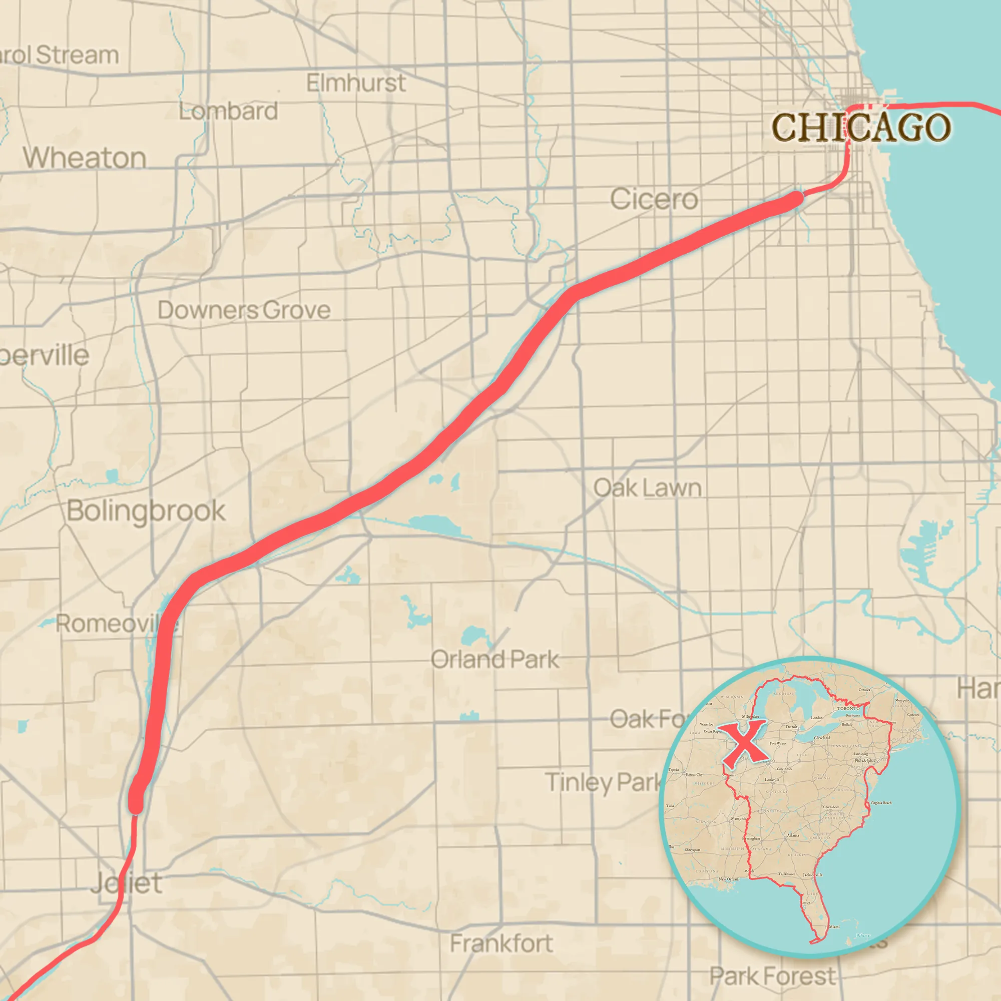
Chicago Sanitary and Ship Canal
— 32 miles
After Chicago, Loopers head south via the Chicago Sanitary and Ship Canal. The canal serves many purposes, including preventing the spread of invasive species with an electric Dispersal Barrier. Originally constructed as the “Chicago Drainage Canal,” it was built to divert pollution away from Lake Michigan.
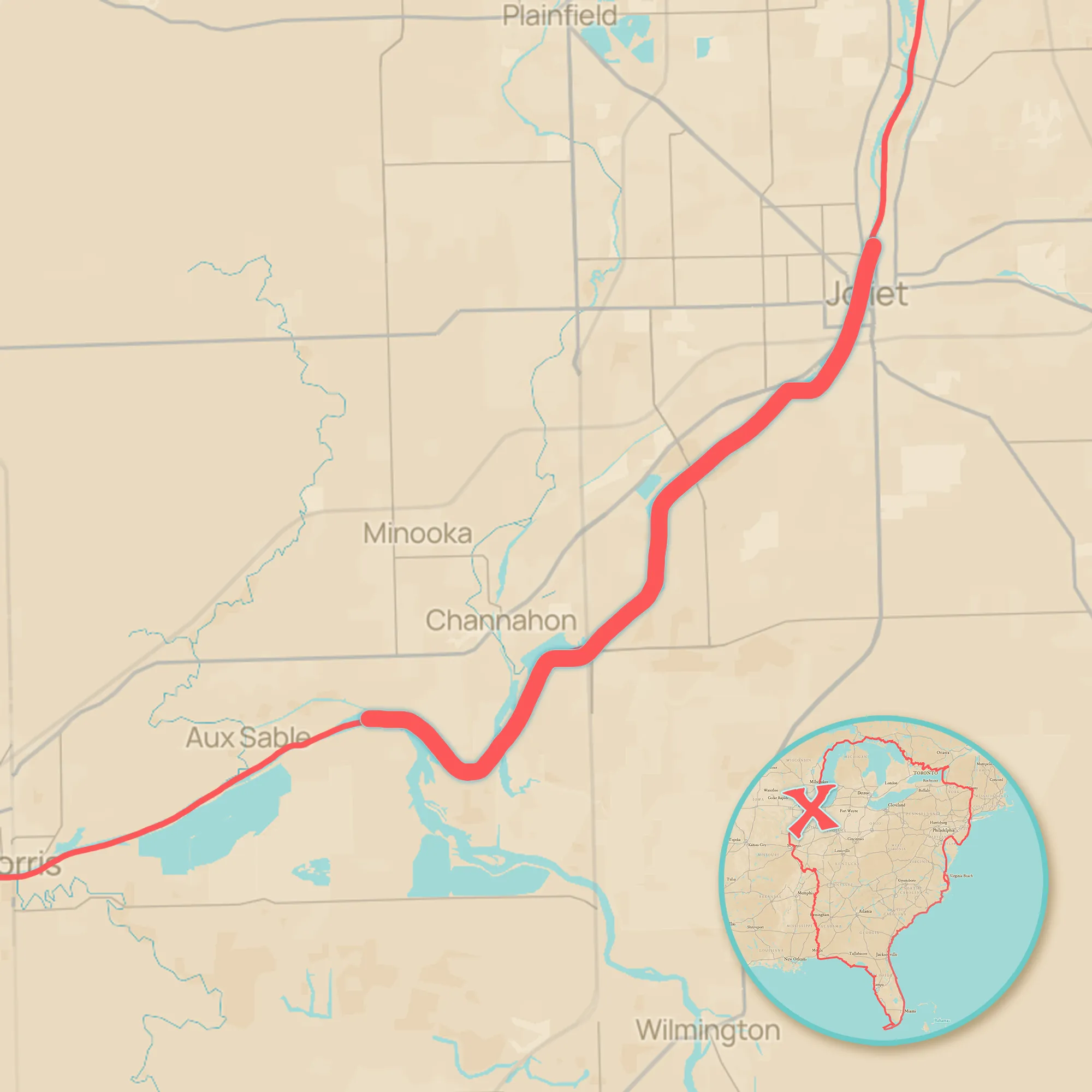
Des Plaines River
— 18 miles
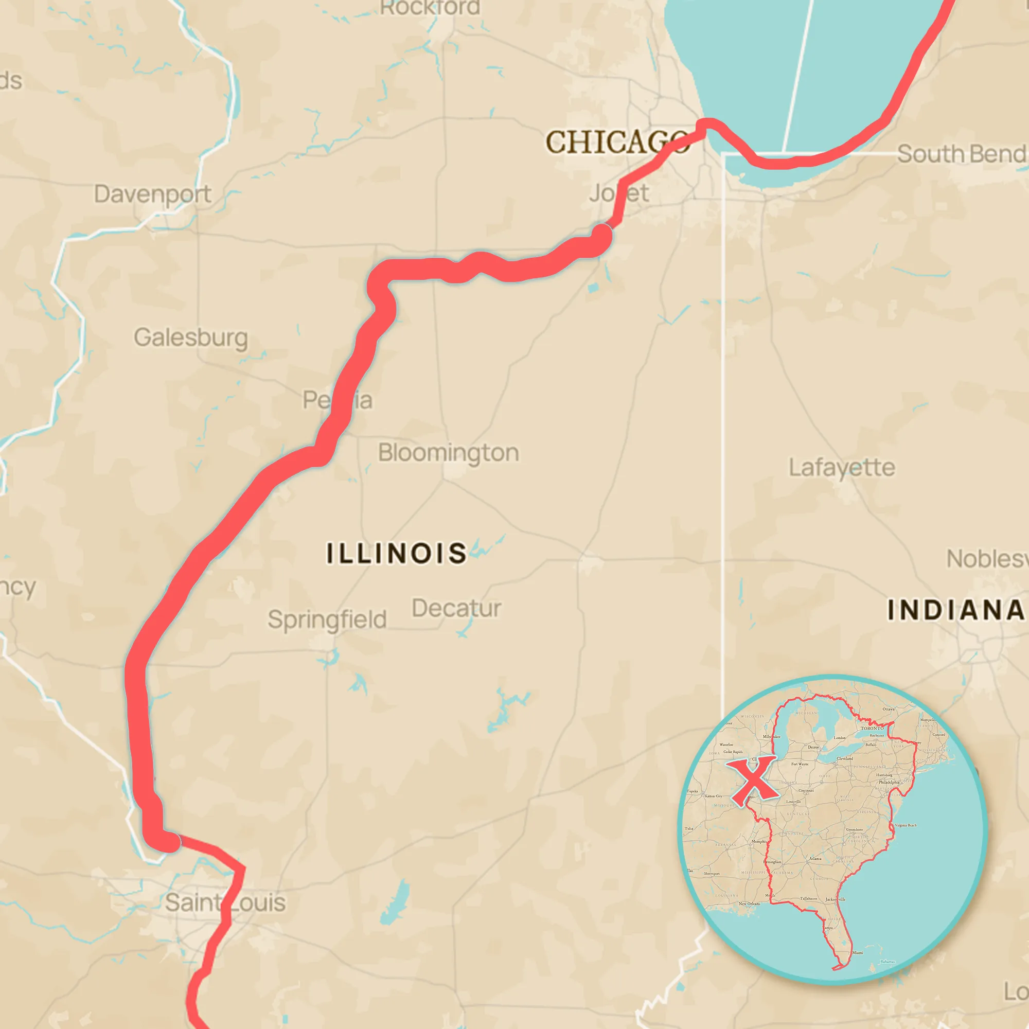
The Chicago Sanitary and Ship Canal flows out into the Des Plaines River several miles north of Joliet, IL. Loopers then travel a small portion of the river until its convergence with the Illinois River north of Heidecke Lake.
Illinois River
— 270 miles
Next, Loopers traverse the Illinois River and waterway, managed by the U.S. Army Corps of Engineers, Rock Island District. There are 6 locks on this section which runs from south of Joliet to just north of St. Louis, Missouri.
Mississippi River
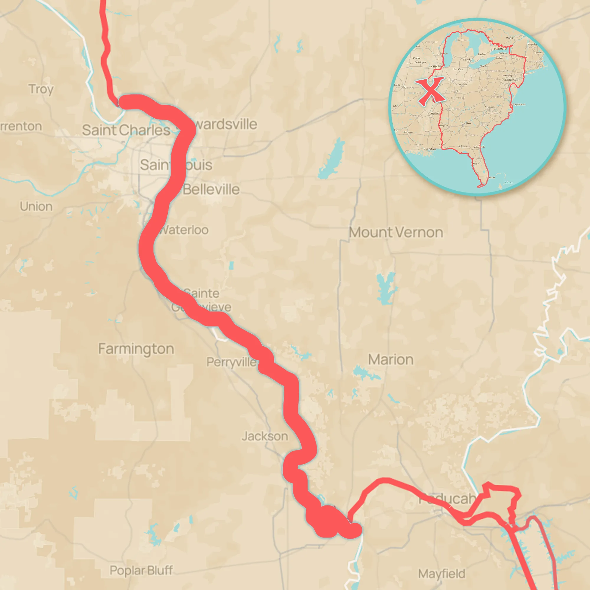
— 218 miles
Most Loopers cruise just over 200 miles on the 2,350-mile Mississippi River. The section of “The Mighty Mississippi” that is included in the main Great Loop route flows from north of St. Louis, MO to Cairo, IL. This portion is part of the Upper Mississippi River.
Ohio River
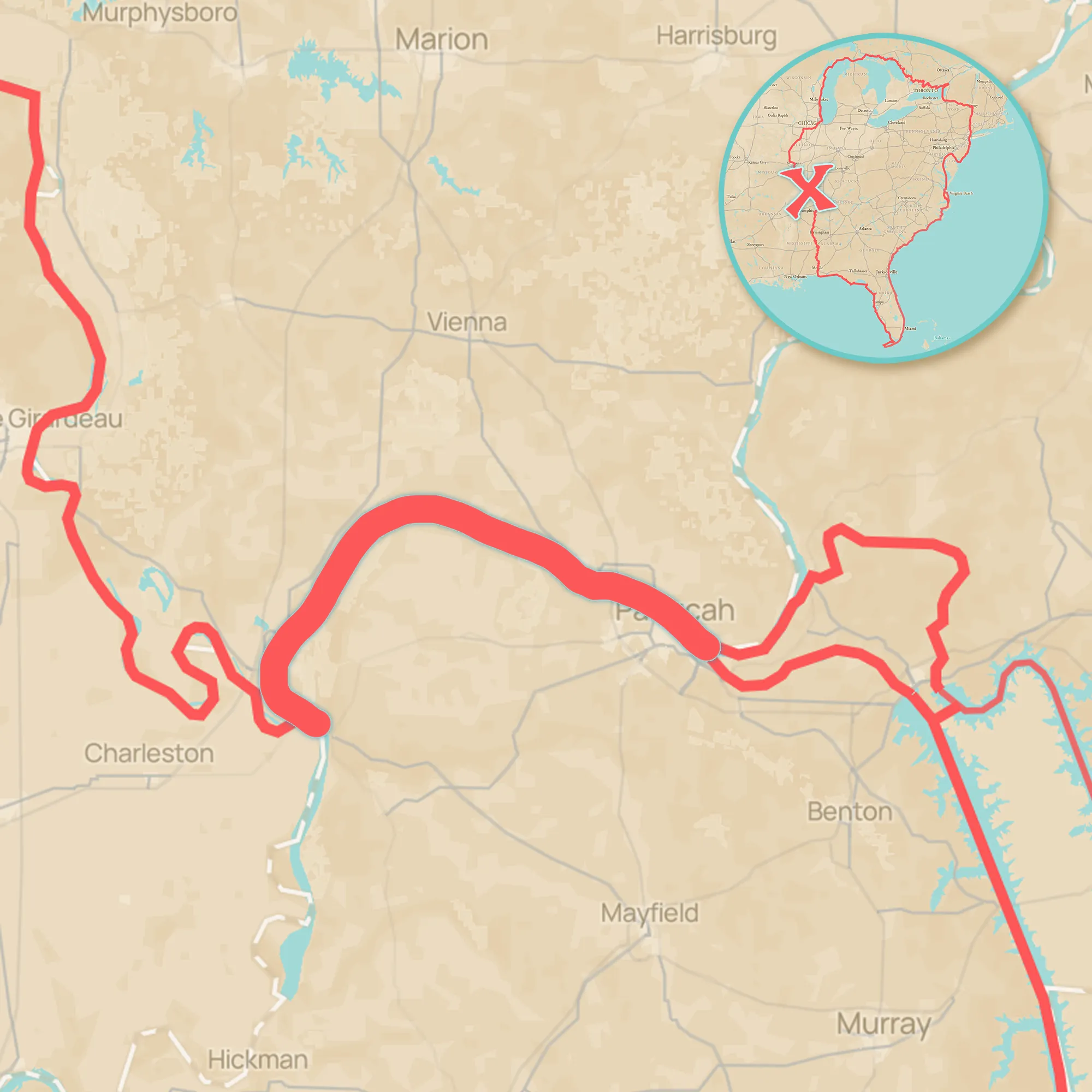
— 48 miles
At Cairo, the Mississippi River continues south, but Loopers head east on the Ohio River for almost 50 miles. The Ohio River connects the Upper Mississippi River to the Tennessee River.
Alternate Route
Continue south to the Mobile Bay via the Lower Mississippi River.
Tennessee River
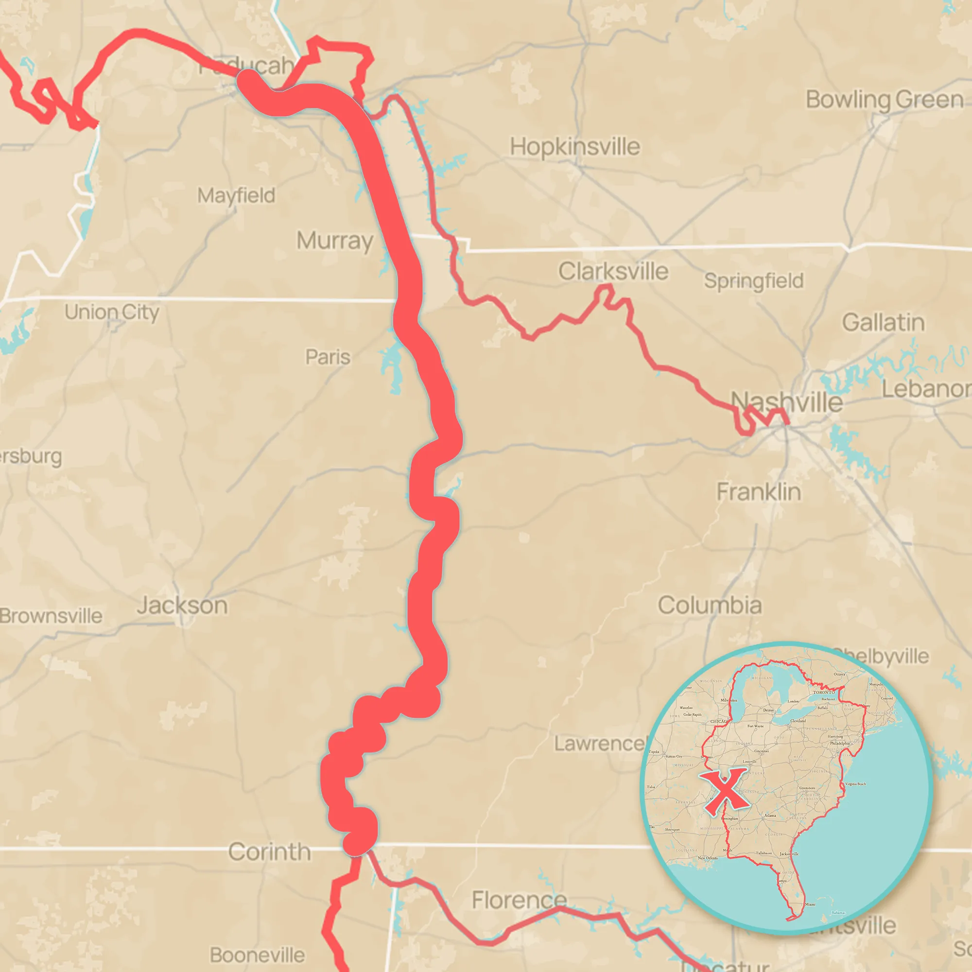
— 210 miles
The Ohio River meets the Tennessee River at Paducah, Kentucky. The Tennessee River runs south for over 200 miles to the Mississippi-Tennessee-Alabama tristate border.
Side Trips
Head east on the Cumberland River to visit Nashville, Tennessee. It’s ~175 miles, one way.

Tennessee-Tombigbee Waterway
— 234 miles
The Tennessee-Tombigbee Waterway (the “Tenn-Tom”) runs from Iuka, Mississippi, through Tennessee and Kentucky, to Demopolis, Alabama. Loopers will transit 10 locks on this section.
Side Trips
Continue east on the Tennessee River – 250 miles to Chattanooga, TN or 450 miles all the way to Knoxville, TN.

Tombigbee River
— 170 miles
The Tombigbee River flows through northeastern Mississippi and western Alabama, before meeting the Alabama River and combining to form the Mobile River.

Mobile River
— 45 miles
Although the Mobile River isn’t the longest river on the Loop, it has one of the largest discharge volumes in the U.S. The Mobile River empties into the Mobile Bay.

Mobile Bay
— 35 miles
The Mobile Bay spans the area north of Dauphin Island, until it meets the Mobile River. When you taste the salt water, you’ll know you’ve finished cruising the inland rivers!
Side Trips
Head west at the mouth of the Mobile Bay and take the Gulf Intracoastal Waterway to New Orleans, Louisiana.
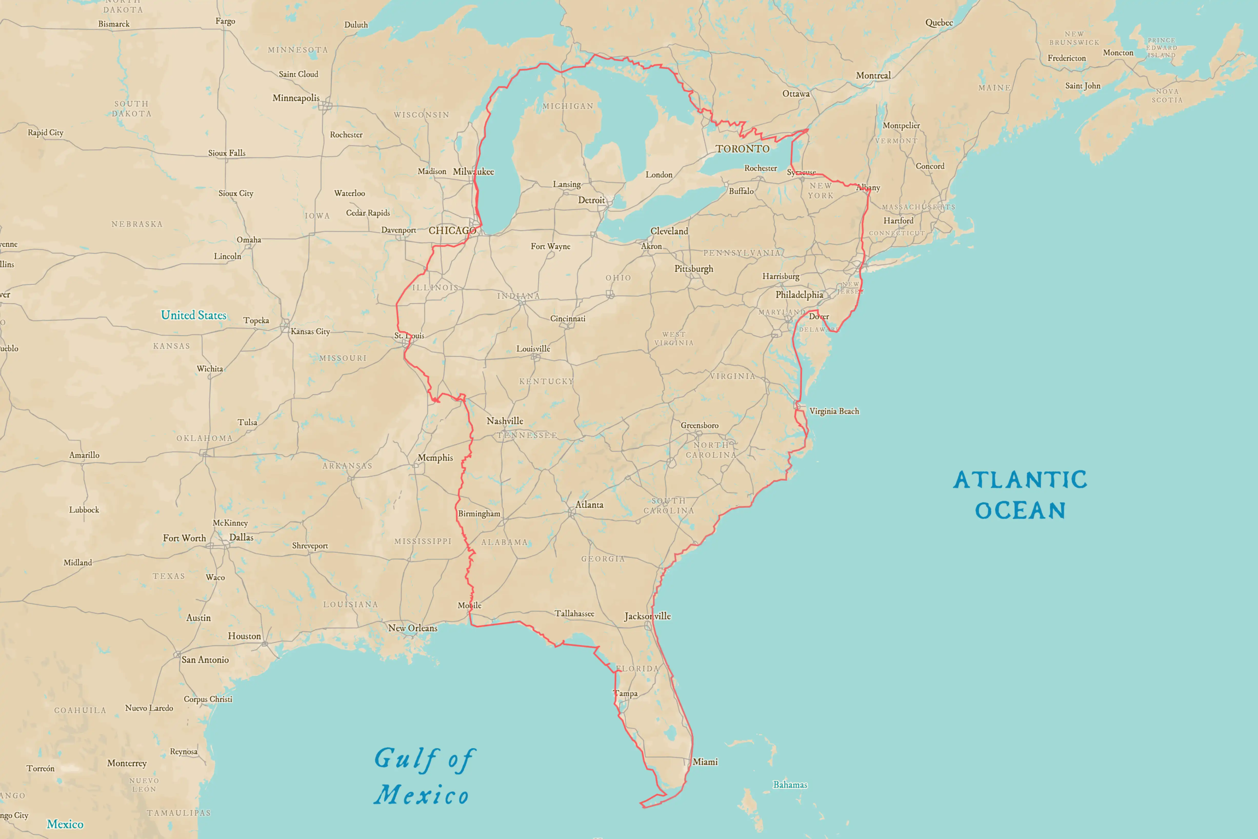
Great Loop Route & Waterways
Route Overview →
Leave a Reply